Nova Scotia, May 31-June 13, 2022

 We had been unable to get to the Maritimes for the past 2+ years due to them having a "Covid Bubble" whereby non-residents were not allowed to enter.  But with the dropping of that restriction it was time to visit the parents and also do some Nova Scotia exploring!  Plus, with the predicted "June-uary" weather for Vancouver, Nova Scotia is actually the better destination for springtime sun!

Inverness just north of the golf course, Cape Breton.  
Launch coordinates which is off the green and public property...do not launch on the golf greens!

Nova Scotia weather is much more changeable vs. Vancouver.  Often it'll be sunny for a few hours then cloud over (or vice versa), hard rain, wind, etc, followed by more sun.  So if you don't like the weather, wait a few hours!  When we arrived we were just getting into a period of north wind, which means any flying to be had would be on the Noel Shore on the south shore of the Bay of Fundy.  (There is also a NW site at the Joggins Fossil cliffs, but that is a further drive.)


Inverness at the golf course, Cape Breton

For those who are unaware, the Bay of Fundy has the world's highest tides so when flying the Fundy coast, you need to know where the tide is, and whether it's coming in or going out.  It'll change up to 50 feet in 6 hours, which translates to ~8 feet per hour.  If you land when the tide is coming in, you may need to run to stay dry!  Get your tide information at the Bay of Fundy Tourism website.

Cabot Trail, Cape Breton

Kiting up from the beach at West Mabou Beach Provincial Park.  Launch coordinates.

The winds were a bit burly during our Noel Shore excursion, so we actually didn't fly, but we found lots of sites!  The great thing about Nova Scotia flying is that the people there are super friendly, and will welcome you onto their beachfront/cliffside/bluffside properties to fly from their backyards.  As well, Google Maps on satellite view and Street View is a great resource...simply find a potential cliff/bluff site, and look to see if there is a row of trees along the edge.  If not and it looks like grass to the edge, it's likely launchable, just look at other things like undercutting cliffs, is there beach below, how to get back up if you beach land, etc.


Havre Boucher, near the causeway to Cape Breton.  This will work in a north wind.
Launch coordinates...access this via the beach and be discreet!


Sunset at our "Glamping off the Beaton Path" campsite near Inverness.  Highly recommend you stay here for at least 1 night!

One thing that is useful to know about flying relatively unknown beach sites, is that you *don't* have to launch from the top.  Often times you an inflate on the beach, and kite your glider up into the lift band, either by walking it into a Venturi area (just make sure you don't get sucked in behind!) or climbing up the bank a bit until the glider bites into the air.  This is quite useful when it's a bit too strong to launch from the top, the top has too many bushes etc, or you have landed on the beach, want to relaunch, but don't want to hike all the way back up.  This works best on smaller bluffs which have an angled face you can climb up on, or a bluff with a low spot/dip/venturi to use.


Havre Boucher, near the causeway to Cape Breton

One other thing we wanted to do was drive the Cabot Trail (a famous scenic drive in Cape Breton) through the Cape Breton Highlands and also do some flying at the various sites.  Protip: drive the Cabot Trail counterclockwise, so you get the cliff views from the proper side of the road!

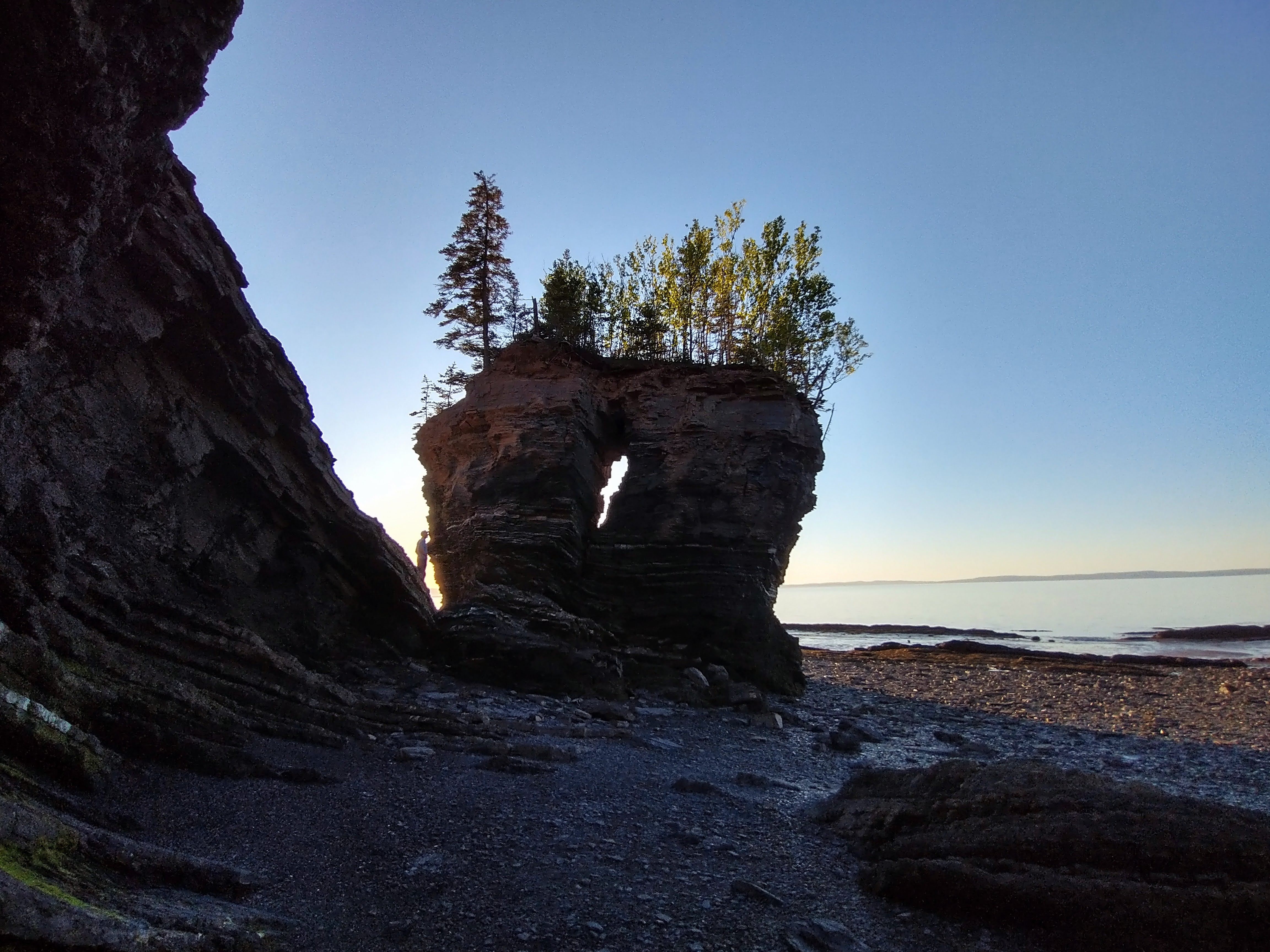
Flower Pot Rock (coordinates), near Bramber on the Noel Shore

The west side of Cape Breton is a goldmine for flying, there are simply few pilots that live nearby, so most of the sites are unflown.  You will find the best sites anywhere from  in the north, to Inverness, to Mabou in the south.  All these sites will take some form of westerly, and depending on the angle of the coastline, it'll be SW or W or NW.  You do not have to worry about the tides quite so much in Cape Breton, so if you see beach, it'll be that amount of beach more or less all of the time.

Flower Pot Rock

Bramber Beach

Once again, Google Maps satellite view, and Google Maps Street View, are your friends to find a suitable launch site.  There are several "established" sites, most notable in Inverness @ Broad Cove, and the Mabou cliffs, but often you will just have to find a site that works for that day's wind direction by Map searching.

Lawrencetown Beach Tea House, near Halifax.  Launch coordinates.

Back on the mainland, there are a couple of flying sites near the Halifax area.  The most commonly flown one is Lawrencetown Beach, with a flying site at the Tea House/Surf Shop, and another flying site a few km's down the road at Half Island.  Both sites take a SW, and there is beach to land at.  There is another site at Hirtles Beach, near Lunenburg, also takes a SW (SSW is better), just follow the public path up the bluff and find a spot which is not too covered with wild roses to lay out.

Flying at Half Island near Lawrencetown Beach.


Lawrencetown Beach Tea House


Half Island Beach.  Launch coordinates.


Half Island.  West launch is just outside the FOV on the left, south launch is in the distance.

Half Island from the south launch.  

Finally, the most flying in Nova Scotia takes place in the Parrsoboro area.  There used to be a school, but is has since shut down, so the flying is now less, but the sites remain!  There are various sites for SW, S, SE, and E.  And once again, be aware of the Bay of Fundy's tides and the fact the beach LZ may disappear during your flight.

Flying south of Inverness (launch coordinates).  The famous golf course is in the distance!

In all these scenarios, please be aware that the winds can change quickly, and what was once a nice breeze can go too strong quickly and now you are being blown back etc.  Keep an eye on the ocean for increasing whitecaps, catspaws, streaking, and also your instrument to see if your groundspeeds are going down as the wind picks up.  And if the temperature is getting too hot, you may get the famous "heat bubble" in which the ground is too hot to allow the ocean wind to come ashore, so you can see the wind just offshore, but it will be calm or not windy on launch.  You can wait all day for the wind to get the final km or so, but it will not arrive and tease you all day!  So if the day is predicted to very hot, this phenomena has a good possibility of happening.

One of the many views from the Cabot Trail.

For a more complete listing of flying sites, go to the HPAAC website.  It is updated regularly so the contact numbers listed there will be current.


Bramber Beach at sunset.


Woodside April 17, 2022

One of the rare good spring days we've had so far this year!  Lots of pilots out as it was the weekend and it was high-ish and cold!


Pretty easy cruising over to Bear and then topped up to 1800m for the crossing over to the Butterfly.  The Bridal side seemed to working better vs. Woodside, at least the climbs felt better, but west of Upper launch I had trouble getting as high as I had been getting further east.  Tried getting high at Gloria for the crossing back to Woodside but that wasn't really working, so returned to Upper launch, that wasn't really working as well :(  


Oh well, back to Lower launch where it's reliable, got to 1700m, and went for the glide back to Woodside.  Unfortunately the west wind had arrived down low and I didn't get any lift on Hopyard or Cemetery Hills, nor the sandbars, so landed at Harvest West dike field.  Thank you Al for picking me up!


46km FAI triangle flight.


Lower MacKenzie Pemberton April 11, 2022

I was in Pemberton for 2 weeks to cat-sit, and had brought my glider.  April is really too early for Pemberton flying as there is still snow around, especially in the Whistler valley.  But after most of the 2 weeks in the rain and snow, we finally had a possible fly day!


It was a bit on the unstable side for big XC, and in any case it was too cold to want to be up there for too long...-20C or even colder at 3000m!  I could only handle the cold for 30 minutes or so, had to land as the air was a bit too dynamic and too north for my liking and I couldn't feel my hands!  I believe Guillaume and Corey flew to Whistler though!


Methinks it's a bit unstable!!


Valle de Bravo November-December 2021

 After a fantastic time in Tenancingo Alex and I travelled to Valle de Bravo, we've been there many times and it's always good XC!

If you are looking to get from Tenancingo to Valle de Bravo, the easiest way is to take a collectivo from the corner outside Nipaqui Restaurante (there are taxi staff there to assign you) and have it drop you at the main bus station in Tenancingo.  Inside go to the Zina bus counter and purchase a ticket to Valle.  Busses are roughly every hour or so.


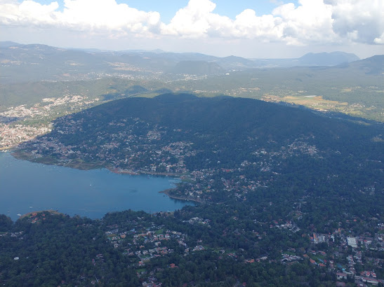
The lake is extra low, you can see the exposed shoreline all around the lake.  Makes for easier final glides!

It's been a few years since our last trip to Valle and the lake is quite low!  So low, in fact, that hang gliders are landing on the now-exposed portions of the lake frontage on a regular basis, and no need to spot-land like in previous years.

Grabbing a taxi to launch is easy as well.  Depending on where you are staying, you will want to grab one either at the Zocalo or in front of the Santa Maria church next to the LZ.  If you are going solo, the taxi should not cost anymore than $200 pesos.  If you are group of 2 or 3, it'll likely be more like $250 pesos.  Occasionally a taxi will try to charge you $500...walk away from those ones!

Looking back at Penon on an overdeveloping day.  Photo by Alex Raymont.

Depending on the time of year and time of day, you may encounter someone manning the gate as you approach launch.  They may be looking for your local club membership, visiting pilot paid-fee QR code, or simply want to record your name for their records.  Each day was different!  Note if you register as a visiting pilot via the local club, you may not receive a response for several weeks, so plan ahead.

To see the various local club launch access rates, you'll need to register at https://clubpenon.org/


And then after registering and you've received the "thank you, someone will get back to you" response, go into the upper right corner and click on the rates button.  There are daily/weekly/monthly/annual rates listed there, and upon choosing and paying for one, you'll receive a confirmation email with a QR code to show upon request.

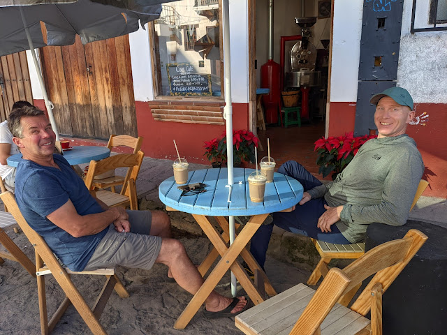
Enjoying an afternoon drink.

Since we were rather early in the season, launch was still green and not crowded, which meant you could set up on launch and not be in anybody's way!  And the bathrooms are fully cleaned between uses with an attendant, also available are some snacks and drinks.  Please support the local vendors!


During our time there cloudbase was a bit on the low side, lower than Tenancingo actually, more like mid-2000 m on most days.  This made transitions a bit more challenging.  Doing the Divis run at 2000m is a lot more stressful vs. doing it at 2900m!

We stayed in Valle for just over a week.  We did have a couple of days where it overdeveloped but it remained flyable every day.  Typically drier conditions are by early-mid-December so if you want to get a reliable week of flying, and avoid the holiday travel season, go to Valle in early-mid-December!


A guide to flying near Tenancingo, Mexico - updated for December 2023

Alex and I had planned a Mexico trip for a while, wanting to go someplace before the winter holidays.  Mexico is an easy choice since it’s easy to get to and the logistics are relatively straightforward.  The usual visiting pilot season runs from November onwards, with general conditions (and cloud base) ramping up in December and considered "strong" in January and February.  We planned to spend about 10 days in Tenancingo before relocating to Valle de Bravo for another 10 days.

Overview of Tenancingo with the Market LZ visible in the centre (filled with vendor tents on Thursdays and Sundays)

When you arrive at the Mexico City airport, assuming you’ve arrived into terminal 1, you can get your Mexican Sim card sorted out right away.  When you exit international arrivals at T1 you will find yourself between doors 7 and 8; simply backtrack to between doors 6 and 7 and you will see a ramp heading up to the second floor. At the top of that ramp is a Telcel store  (open 9am to 5pm) which will sell you a Sim card and a phone plan for very cheap.  If the Telcel store is closed, you can also visit the Airport's 7-11 or local OXXO stores to get sorted out.  I’m sure there’s cheaper ways of getting yourself a Sim card once you leave the airport but this way gets you set up right away in case you need to start communicating with other pilots ASAP.   Another option is for you to install an e-sim prior to leaving your home country.  2 options are Airalo or Ubigi...both have Mexican e-plans and you'll be sorted as soon as your plane lands in Mexico!

Christo Rey statue in Tenancingo.  If walking up, it's ~1200 steps once you get to the staircase!  Photo courtesy of Alex Raymont.

Our plan was to take the AeroCaminante bus from the Mexico City airport to Toluca (245 pesos) and then get a taxi from Toluca to Tenancingo (400-600 pesos depending on your haggling skills).  The AeroCaminante ticket sales is just past the Telcel store on the second floor. Walk through the food court and you will see the ticket booths on the other side…there’s a bus every hour.  

If taking the bus from the Mexico City airport, you end up at the AeroCaminante bus station in Toluca: a smaller, separate bus station from the much larger general Toluca bus station (which houses the "regular" non-Aero Caminante company, along with the myriad of other bus companies).  So be aware if you plan to bus further than Toluca, you will need to get from one station to the other via 45 minutes of walking or a 10-minute taxi ride (70-100 pesos).  If you choose to take a bus from Toluca to Tenancingo instead of a taxi, it'll be from the larger bus station (using the "Zina/Teo" company) and cost 44 pesos.

Between Tenancingo and the Toluca volcano are many greenhouses, so choose your LZs carefully!  Photo courtesy of Alex Raymont.

Daniel Pedraza and his daughter Daniela are the main points of contact if you want to arrange for drivers or access to the launches.  Daniela runs a taxi company so if you require a ride she will send one of her taxi drivers to come get you.  From MEX airport is 1500-2000 pesos, from Toluca is ~600 pesos.

Petroglyphs in the jungle on the La Malinche ridge

There are quite a few Canadian paraglider pilots staying in Tenancingo over the winter months. If you are new to the area and want organized guiding, contact Sea To Sky Paragliding since they run excellent weekly tours all winter in this area (Alex and I used them in 2018...highly recommended!).  Casa Del Piloto is the main house where most pilots stay.  But if the house is full there are plenty of Airbnbs and hotels around.  Casa Del Piloto will often have a shuttle running from their place twice a day. Check with them to see if they have space. If not it’s quite easy to take your own taxi to the launches. If you need to find a taxi walk over to the Garis department store (next to the LZ).  There is a taxi stand inside the parking lot, and the taxi drivers there can take you to either the morning Bistro launch or the afternoon La Malinche launch.

Lookout Rock on the La Malinche ridge.  Photo courtesy of Alex Raymont.

To get to the Bistro launch have the taxi drive you to just outside the town of San Simon el Alto and then direct them to the Telcel tower (it’s a dirt road but passable via taxi).  Launch is the field below the tower.  It faces SE so you can fly there late morning or early afternoon. A local tandem pilot from Malinalco (Pablo Lopez) will often be there on weekends.  Note: as of December 2023, the launch is covered in a bean crop, so you'll have to launch at the very bottom of the slot.

Brad getting ready on the Bistro launch.  November is prime wildflower season!

Bistro launch is generally considered a cross country site, so once you get high you have the choice of flying back to Tenancingo, going to Chalma to the SE, flying towards the volcano, or attempting to fly to La Malinche.  If you make it to La Malinche you can then top land and have a nice siesta before re-launching for the afternoon restitution and then flying back to Tenancingo.  Here is a typical flight from Bistro to La Malinche and then to Tenancingo.  

If you choose to land at the bottom of Bistro, near the town of San Nicolas, a common LZ is the “Lemon field”, and there will be lots of collectivo (shared) taxis driving to Tenancingo or Malinalco from the road.  Just flag one of them down and squeeze in (it should be less than 50 pesos from Malinalco area back to Tenancingo).

Another nearby flying site is called El Picacho.  This can be used pretty much all day (it faces south) and you can either fly locally (landing here...don't land at the golf course!), or fly XC towards the Toluca volcano or elsewhere.  Have a taxi take you to Santa Cruz Tezontepec, take the turnoff here, and drive south to the end of the road where it turns to dirt.  Then keep walking for ~10 minutes (slightly downhill) until you reach launch.  Here is a typical flight from El Picacho to La Malinche and back to Tenancingo.  Note: the local farmer/landowner, if present, will ask you for a 50-peso launch fee.

Above Santa Cruz, looking south.  El Picacho launch is off the end of the plateau where it drops down to the  Malinalco valley.  Photo courtesy of Alex Raymont.

If you prefer to wait for an afternoon flight, La Malinche faces SSW and is flyable from about 11am until dark.  If you end up taking your own taxi to this flying site (100-120 pesos) have the taxi driver take you to the town of Terrenate, keep driving uphill until the road turns to dirt, and then drop you off at the large tree after ~200 m of driving on the dirt road.  The road falls apart at this point so it’s easiest to just walk it and it takes 8-10 minutes.  Note as of December 2023: Daniel plans to have the final part of the road to launch paved sometime in 2024, so there is the possibility of taking a taxi all the way to launch, once paving is complete!

La Malinche launch and the pilot's hostel.  Tenancingo in the background.

On launch you will find the hostel that the Pedraza family has built. Pilots are welcome to stay there: inquire with Daniel or Daniela about pricing, and there is a bathroom, kitchen, cell signal, hot water, and electricity.  There is also camping welcome on launch for those who choose to bring their own tents.

If you sink out at La Malinche, you end up here.  There is a hiking trail (1 hour) back to launch.  Photo courtesy of Alex Raymont.

The shared kitchen at the pilot hostel at La Malinche.  Photo courtesy of Alex Raymont.

The shared bedroom and bathroom with bunk beds.  Photo courtesy of Alex Raymont.

He has several rooms, one room is bunkbeds to accommodate up to 4 pilots, and he has separate rooms for a couples or those who prefer a bit more privacy.  And the kitchen is fully equipped for cooking.

The matrimonial room at the La Malinche hostel, with a fantastic sunset view.  Photo courtesy of Alex Raymont.

The Pedraza family has done a fantastic job with the take off!  The launch is green grass and is perfectly groomed with lots of space to lay out 10 gliders.  (As of December 2023: Daniel plans to enlarge launch even more by taking out the rocks near the outhouse on the west end.)  And it’s relatively easy to top land as well, provided you can get down through the abundant lift. Many pilots take a few go-arounds before making it in!

The Pedraza's Mexican dinner offering on La Malinche launch.  Photo courtesy of Alex Raymont.

Definitely ask the Pedraza family about their "Mexican dinner" option on La Maliche launch!  They will do up a fantastic meal for you or a group with multiple Mexican dishes and you'll be stuffed by the end of the night!

Some top-landings go better than others!

If you choose to land in Tenancingo there are a couple of options. One landing zone is called 2 Trees, is directly behind launch and easy to glide to from about 2300m.  Another common LZ is the Cinema, a short distance beyond 2 Trees and closer to the main road and taxis back to town.  If you can make it to 2700m you can then make the glide to the Tenancingo market landing zone.  Be aware that this LZ will be full of parked cars and tents on market days (Thursdays and Sundays). On these two days you will need to land in the unused corner which is closest to the powerlines and road.  There is a prison close by. When approaching the landing zone make sure not to overfly the prison directly!


La Malinche has excellent hammocks for an afternoon siesta!

Tenancingo is a fantastic place to fly, and a good alternative for those who find Valle de Bravo too busy, too expensive, or want to explore a bit more of "rural" Mexico.  If you are a lower airtime pilot this area may be more suitable vs. Valle de Bravo since it does not involve the crux of having to XC it back to the lake each flight.  For those wanting a bit of XC, this area has lots of crossings, valley systems, and interesting local meteorology.  There are also other nearby sites within 1-2 hours (Ixtapan, Taxco, etc) so there are definitely lots of sites to explore and not use the same ones day after day!

2021 Red Rocks Fly-in, Monroe UT

The Red Rocks annual Fly-In (Monroe, UT) is North America's largest PG and HG flying event, last year it was around 350 pilots and this year it was capped at 325!  I had flown Monroe during the US Nationals in 2011, loved it then, and have been wanting to get back ever since.  It represents some of the most awesome big-desert flying with the strong season being July and August, with conditions mellowing in September and October.  XC is possible all spring and into fall, and flights of 200+ km (mostly to the E or NE) are possible.  Cloudbase can be upwards of 23,000', bring O2 if you plan to get high (and stay below 18,000')!

Glenwood Mountain overlooking Monroe in southern Utah. 
The LZ is on the edge of town on the far right.

I had been on the waitlist for the 2021 event since June, and got the notification that 2 spots had opened up for me and Alex if we wanted them; this happened mid-September, not much time to plan!

Over the valley looking at Monroe Peak.

With Covid still keeping the land border between Canada and the US closed, the only way for Canadians to enter the US is via air, so that meant buying plane tickets (either SLC or LAS will work) and renting a car.  And of course the US needed a negative antigen test to get in, and Canada required a negative PCR test to get back, and double vax to avoid quarantine upon return.

However once taking care of the logistical hurdles, we were in Vegas and driving up to Monroe Utah!  Heads up that despite it being hot (30+ C) in Vegas, it can be quite cool in Monroe (especially in the mornings) since you are driving up to 5300', snow is possible in the mountains, and at cloudbase it can be below freezing, so you need to bring clothes for both hot and cold!

The organization for the event is fantastic!  Stacy Whitmore, Jonathan Leusden, and Jef Andersen are the primary organizers, along with an army of assistants.  They have daily weather briefings in the morning at the Monroe LZ, regular shuttles to 3 flying sites (with a 4th unofficial site often being used as well), bathrooms with running water and electricity at the LZ, grass (!) to pack up on, and a fantastic coupon book with free/discounted meals at the local restaurants which pretty much covers the event's entry fee.  Plus they have 2x daily (once in the afternoon, once at night) presentations on a variety of subjects suitable for all skill levels.  They have several Telegram groups set up, with one of them being a dedicated retrieve channel if you land out within a certain radius of Monroe: they will come get you!

Driving through the canyon enroute to Monroe Peak is stunning.

There are 3 main launches the locals use.  Cove Peak is the most-often used launch at around 8700', and has S, W, and N launches.  From there you can bench up to Glenwood Mountain (Signal Peak) and have access to the entire W-facing mountains from Bryce Canyon to Salt Lake City, with a few gaps to make things interesting.  Cove launch itself is rocky but with carpeting, and once you get high enough, are treated to the Aspen trees turning to a gold color, a beautiful contrast to the evergreens, rocks, and snow.

Cove launch with the main S and W launches, and a smaller N launch close to the antennas.

Cove's north launch with the west-facing cliffs in the background.

Monroe Peak is a very high launch around 11,200', and has S and W launches.  The S launch is rarely used (it's a bit line-grabby with sharp rocks) and most go to the W side where the rocks are more pebbly and less line grabby, plus it's a huge area and toplandable if you wanted.  

Monroe west launch is huge!

Mount Edna is a morning site and is at ~11,700', Utah's highest vehicle-accessible takeoff.  There is a chance of snow on launch, so bring your boots!  In fact you probably want boots for all the launches...the rocks are big enough on all launches that you want the extra protection and ankle support, especially since you are launching at altitude so need to run that little bit harder/longer!

Junction launch is an easy 2WD and a short 5-minute hike from the hairpin turn parking lot.
  Photo courtesy of Alex Raymont.

In addition to these 3 official sites, there is also Junction (same weblink as Edna, scroll to the very bottom), which is south of Monroe, close-ish to Edna, and a morning site with E and NE launches.  Many XC pilots use this launch since it offers a morning start to an XC route and has easy access via 2WD.  During the event we had XC flights from here on almost a daily basis.  My first day I flew from here and flew ~100km, getting to 17,700' and landing at Salina!

Junction launch with the Aspens changing color.

There are many other smaller sites, such as Poverty just south of Monroe Peak, a N-facing ridge soaring site (similar to POTM North side) when it's too windy up high.  On several of the north-wind days, pilots went there for a change of pace.

While the XC flying potential is fantastic even in late September, there is also plenty of local flying and many pilots will fly multiple laps from Edna/Monroe/Cove all day.  And in between flights, you can hang out at the LZ where food trucks are parked so you don't even have to leave for lunch/dinner before going back up for a glassoff flight.

Flying north from Junction to Salina ~100 km, I stopped at 17,700' and cloudbase was higher still!

And the glassoffs are great too...Cove is flyable pretty much every evening until dark in light ridge/thermal conditions, and the valley bottom will start releasing at dusk as well, so you can fly over the town and easily stay up...many times we watched pilots flying after the sun had set and into civil twilight.

Falls colors in full swing

Lots of places to stay as well!  You can go all fancy in a hotel or AirBnB in Richfield (about 15 minutes drive away) or camp at the local RV park, or Van-life it on the abundant National Forest land (free), or stay at Peter Reimer's if you prefer to tent.  He is a local who loves having pilots stay in his front yard.  Simply park in his parking lot and put your tent up on his lawn across the driveway.  He has Porta Potties, running water, picnic tables, and a few extension cords for charging your instruments.  He'll also open up his workshop for coffee/put the TV on if you want to just hang out.  Note: due to the Elk Farm next door, you may want earplugs...the male Elk in rutting season can be quite noisy with their mating calls ;)  Peter's property is available throughout the year, and he has a donation box set up so you can drop in a $5 or $10 per night to express your appreciation of his hospitality.

Cove is reliable pretty much every afternoon and evening.

Peter is not the only one welcoming pilots.  Pretty much the entire town of Monroe loves having us and were so friendly!  We would have random people come up to us and thank us for visiting, saying how beautiful the PG's and HG's look in the air over town, would show up at the LZ with the family and a picnic blanket and chairs to watch the landings...it's a big deal for this town!

The first snow of the season!

New for 2021, the Fly-in was also overlapping with the first X-Red Rocks hike-n-fly competition.  In this 3-day comp pilots would get a daily task: some of the TPs could be acquired via the traditional method of overflying them, other TPs could only be captured via hiking to their coordinates.  And of course the pilots would have to hike to launch in the first place.  Doing all this at altitude adds an extra element of difficulty, especially for those coming from sea level.  Canada actually had 1 pilot entered in this comp, James Elliot, and he came in 7th place overall despite coming from sea level and flying with no supplemental oxygen.  Congratulations James on a splendid achievement!

James ready to go on Day 1!


Oh yeah, there are free hotsprings nearby!  You *can* visit the fancy Mystic Hot Springs, but they are pay-only, and the locals go to the free ones called Red Hills Hotsprings.

The upper, *very* hot spring at Red Hills.  The "regular-hot" pools are below.

Monroe has turned these hotsprings into a small park with a changeroom/bathroom and trash bins which are cleaned regularly!  Plus the locals will come by to clean up the hotsprings of stray trash, adjust the heating/cooling, re-build up the walls separating the pools, etc.  A great place to soak after a hot dusty day of flying!

If you are interested in some really interesting hotsprings, check out Meadow Hot Springs, about 1 hour drive away.  These (also free) hotsprings are on private property so please be respectful of the landowner.  It features 3 pools connected in a giant loop.  The hottest one has a 30' deep cenote-like hole you can dive down into (there is a "pull rope" to haul yourself down and guide you back up).  Just make sure not to bang your head on the overhanging ledges when ascending.  Bring goggles for the best underwater views!

One of the pools at Meadow Hot Springs has fish!

Plus there's oodles of National Forest, State Parks, and National Parks close by.  Bryce Canyon is the closest, but there's also Zion, Grand Staircase, Capital Reef, and Grand Canyon not too far away.

If you have the time and want to do a western desert road trip, definitely keep this event in mind; we flew 7 out of 7 days!  It's usually the last week of September and fills up quickly.  Keep up to date by visiting the CUASA website.  I believe they will open registration for 2022 in a month or so.


Hiking in Red Cliffs National Conservation Area, just outside St. George, UT

Woodside September 16, 2021

Rather stable conditions but good practice for those light scratchy days!  Bobbed around at launch height or below for most of the flight, but occasionally able to get above 850m.

It was actually blowing over the back on launch for much of the day, which slowed down launch cycles and made for some interesting toplandings.  Peter's toplanding was quite fast he reported, and Alex resorted to a fly-on-the-wall landing to accommodate the east wind.

A very nice fall day, not much for XC, but fun to hang out with a bunch of pilots on launch and land at FlyBC for possibly the last time, since they have sold their property and will be unavailable for pilot landings after November 2021.

Interior Road Trip September 9-15, 2021

With school back in session, most people back to work, and the forest fire smoke dissipating, it was time for an Interior road trip!  Started with a flight at Bridal Falls (we were driving by anyways!) and it was doing that thing where the south wind causes the cloud to "shelf" over the Bridal range.  Still flyable and easy to get to cloud base at 1700m, but going west I stopped at Gloria since Elk Mountain was very shady with zero sun on the slopes, whereas the Bridal ridge still had sun patches every so often.

Bridal Falls flight.

After spending the night near Hedley, we pulled in to the Ripley/Ottos LZ the following morning and hiked up to Ripley to join up with Pete and Rob for a quick ridge soar before the wind died and the clouds came in.  It's a good thing we were a group of 2...we startled a very fat black bear who was snoozing in the bushes next to the hiking trail and he exploded out of the bush away from us...we later on lots of bear scat with embedded berries, and Alex reported seeing him again from the air later on.  

It's a short hike up to both Ripley and Ottos.  Photo courtesy of Alex Raymont.


The local club has a "clubhouse" set up on the way to Ottos launch, on the private property of the local landowner who is happy for us to stay on his property so long as we are quiet and clean up.  It has a fantastic view and is secluded and gated off, perfect for camping!  And you can hike up to Ottos right from there, and land there if you like, which is what several people did the following day when it was light and hadn't yet turned on.  Alex and I waited for it to turn on a bit more before launching, since the site is low enough that you can easily sink out.

Dinner at the Ottos clubhouse!  Photo courtesy of Alex Raymont.
Ottos flight.

Both Ripley and Ottos are lovely sites and the local pilots are very friendly and will happily show you the launches and LZ...just hit them up on the local WhatsApp chat group!

Ottos launch with the lingering forest fire smoke near Osoyoos.  Photo courtesy of Alex Raymont.


After a couple days in the southern Okanagan, we relocated to the Vernon/Lumby area to fly Coopers since there was a light wind day coming up, and we hadn't flown Coopers in years.  Freedom Flight Park is at the base and caters to both HG and PG pilots, does lessons, towing, ultra lighting, and has camping and kitchen facilities available.  Many pilots set up shop for the entire season and just base out of there!  The launch is also fantastic...they have carpeted pretty much the entire thing so you can lay out anywhere and keep your gear clean, nice!
Baldy launch has some new black carpet!  Photo courtesy of Alex Raymont.

Despite the light winds it was actually blowing over the back up high, and once launching it was very leeside but stay-up-able.  Cloudbase was around 2400m with lots of clouds over the plateau behind launch, these clouds later on dissipated as the afternoon dried up.  Flights to almost Vernon Mountain and return, plus some local triangle flying around the Lumby area.  It was so nice to still have XC conditions in September!
Alex launching King Eddy on an almost-blown-out day.


Lilloet just outside the visitor centre.

Lots of flying at Baldy/King Eddy as well with the Paraglide Canada crew plus locals.  The Baldy launch is currently carpeted as well and I believe they will be "beefing up" the carpet next season.


After a couple days in the Vernon/Lumby area, we decided to hit up Pemberton on the way back to Vancouver for a final XC flight to close out the local season.  We actually saw new snow on the peaks along the Duffy Lake road, winter is definitely coming!  And it was extremely cold at altitude in Pemberton (2500m), very much like early Spring flying.  It was actually overdeveloping in spots and it felt a bit pushy to stay in the air too much longer, so I just did the run to Copper Dome and return, landing at the Beer Farm in the shade from an overdeveloping cell.

On final glide to the Beer Farm with the overdevelopment all around.
Pemberton flight.

Nice landing at the Beer Farm, I wouldn't want to be landing in Pemberton now!

All in all a successful road trip to close out the local XC season, and time to start thinking about a winter flying trip!