After a week of flying in Drama, it was time for us to relocate to Krushevo in North Macedonia for a week of unstructured self-guided flying.
 |
| Krushevo is the highest town in North Macedonia, and one of the highest in the Balkans. |
Now, it’s difficult to get from Drama to Krushevo via public transit…there used to be trains and a bus, but since Covid those have gone away, or involve an all-day ordeal of bus transfers and missing connections. And since North Macedonia is not in the EU (whereas Greece is), most car rental companies will not allow you to drive between the two countries. So you either have to fly from Thessaloniki to Skopje and then backtrack via bus/taxi anyways, or hire a driver to take you directly.
 |
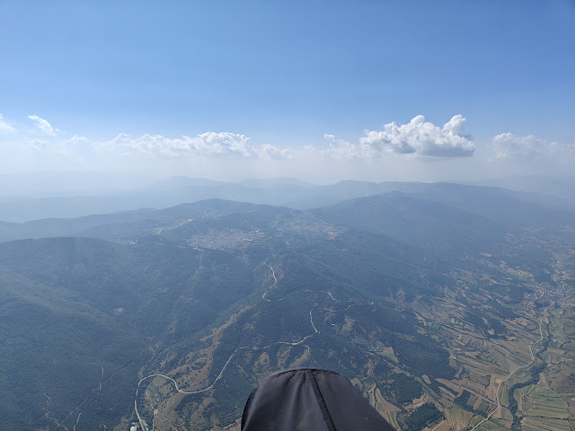
| Flying the flats north of Krushevo. Photo courtesy of Alex Raymont. |
I contacted the local school in Krushevo, “Paragliding Macedonia”, and got the contact for a local driver, who drove to Thessaloniki airport to pick us up, and drove us back across the border to North Macedonia and onwards to Krushevo. For this service (up to 3 pilots in the car) it was a total of 150 Euro. It was a great decision as our driver spoke the local language and was able to get us through the land border with minimal fuss (although there was a lot of gesticulating and animated language between our driver and the border guards…not quite sure why!).
 |
If you show up at Krushevo in the summer, chances are you'll run into a comp!
Photo courtesy of Alex Raymont.
|
Krushevo itself is situated up high above the Pelagonia valley at 1350m ASL, which means you can be a bit cooler, temperature-wise; as well you are already at launch altitude and it’s a short 10 minute drive to the main takeoff. Many pilots stay at the Montana Palace Hotel, but this is situated outside the main part of Krushevo so you’ll be walking for any restaurants/food/groceries/ATM, so I think it’s better to stay closer to the town centre. Most pilots will eat at the “Skar” restaurant (which does breakfast as well as lunch and dinner), located in the town centre next to the church.
 |
Arriving back at Krushevo after a triangle, to topland in the fields behind town.
|
There are 2 takeoffs just outside Krushevo, and any taxi can take you there. You can usually find a taxi near the “Roma” pizza restaurant, or inquire at the local paragliding info centre to see if they have any shuttles. It’ll cost around 300 MKD / 5 Euro. The main takeoff faces east and is the main comp/XC launch, with space for ~10 pilots to launch simultaneously, shade and benches to hang out under, and often a vendor selling water/snacks. There is also a bathroom and water spigot which is unlocked for comps (and chances are, if it’s summer, there will be a comp going on!). If, for some reason, it’s blowing over the back, or you want to fly later in the day, you may need to visit the other side of the ridge, facing west, where the smaller alternate takeoff is located.
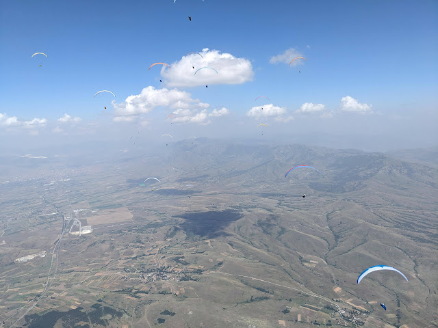 |
Lots of clouds and pilots to mark the thermals on the flats!
Photo courtesy of Alex Raymont.
|
As Krushevo is mainly an XC/comp flying site, most pilots fly out-and-returns to the south or north, or big triangles to the other side of the valley near Prilep. There is also a flying site just below the Treskavec Monastery above Prilep for afternoon/west wind.
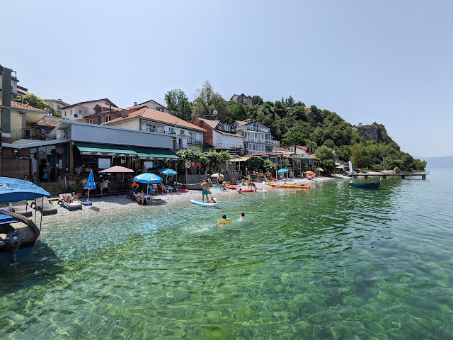 |
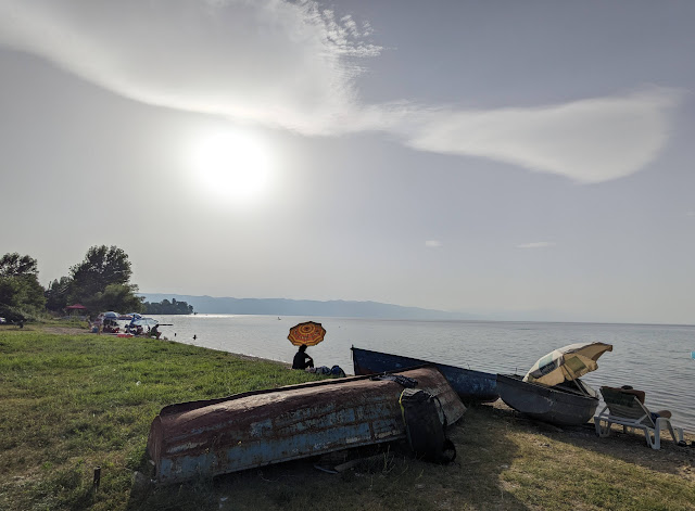
Lake Ohrid swimming. Photo courtesy of Alex Raymont.
|
You have the choice of either mountain or flatland flying, or both, depending on stability and cloudbase. Most pilots opt to fly the mountains first, and then when the first Qs start popping out on the flats, head out there, before returning to land at one of the LZs at the base of the road leading back up to Krushevo. While we were there (late June) the flatland lift was plentiful even if there were no clouds to make things obvious. You can fly quite far north until you hit the mountain range bordering Skopje, at which point you can commit to going deep (maybe for vol-bivy) or follow the curve of mountains around to the east.
Typical triangle flight from Krushevo.
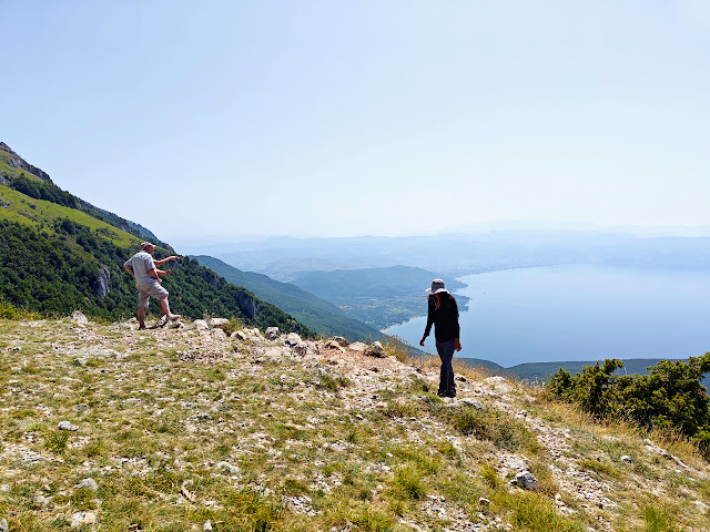 |
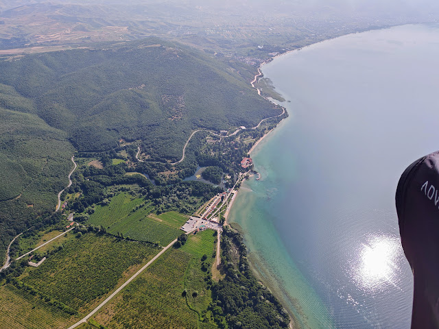
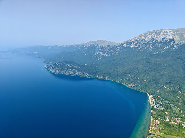
Lake Ohrid launch in Galicica National Park.
|
If you want a change of scenery, you can always head to Lake Ohrid for some freshwater beaches or the resort town (we hired a local driver); there are actually flying sites there too! The one we went to is in Galicica National Park; there is a small kiosk at the bottom of the road up and a person charging entry (I think it was 100 MKD per pilot). Stop at the St. George chapel on the side of the road, and launch will be anywhere in the meadow below the hairpin turn.
 |
| Lake Ohrid: the border with Albania just ahead of me. |
Be aware there are powerlines to the north of launch and if you get up and behind launch and then low, you may need to topland back there. Not a big deal, you can just relaunch from there, but it is in a bit of a venturi, so if it’s forecast to be windy, it’ll be windier here. Plan accordingly! There is an official LZ in one of the few fields between the mountain range and the Lake, or there are 3 beaches at the south end of the Lake. According to the local tandem pilots, don’t land at the closest beach. Choose the farthest-from-launch, and be prepared to avoid sunbathers, cars, bushes, etc. But it’s very nice to land and be able to just jump in the water to cool off!
Lake Ohrid flight.
 |
The beach landings at the south end of Lake Ohrid.
|
 |
Watching the lenticulars form at the end of the day.
|
If you are looking for a place with reliable and varied flying, and want some infrastructure in place (other pilots to fly with, cheap busses/taxis, moderate climate), you should consider Krushevo. Given that there are usually several weeks of comps in the summer months (I think for 2023 there was something like 6-in-a-row!), it's gotta be one of the more reliable spots for XC flying.


